The Old Road Beneath the New Street
How to trace an old road beneath a new street: read maps, street plans and field clues to separate persistent corridors from tempting guesses.
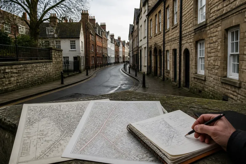
On a walk through a town centre, a street may bend where its neighbours run straight, then narrow beside a row of older buildings. To trace an old road beneath a new street, treat those oddities as clues to investigate, not proof that an ancient route lies below the paving.
Routes persist for practical reasons: a corridor may connect useful places, avoid difficult ground or offer a convenient way through a growing settlement. But streets also shift, merge, disappear and acquire new names. A careful reading separates continuity of direction from continuity of the road itself.
What counts as continuity?
A route is a line of movement between places. A street is a built feature that may occupy part of that line, reshape it or replace it. When people say an old road survives beneath a modern street, they may mean several different things:
- Corridor continuity: movement between broadly similar places still follows the same strip of land.
- Alignment continuity: the route follows much the same direction over a substantial stretch.
- Surface continuity: an older road surface or track remains physically under a later one.
- Name continuity: a local name has endured, even if the route or its function changed.
These are not interchangeable. A new street might preserve a corridor while taking a different line through it. A familiar name might move to an adjacent road. Even where maps show a persistent alignment, they cannot by themselves establish what lies beneath the surface or when a road began.
It helps to describe the claim precisely. “The modern street follows an older route between the market area and the town edge” is more defensible than “this is an ancient road” if the evidence shows only a matching direction and connection.
Which records help?
Begin with maps that show the same area at different stages of development. A historic county map can suggest a regional route, while a detailed town plan may reveal how streets and property plots related to it. Current Ordnance Survey mapping helps orient older material, but its symbols and level of detail differ from those on earlier maps.
Compare features that are less likely to shift than a street label. Look for repeated bends, junction positions, bridges, gates, churchyards, long property boundaries and the edges of built-up land. A route that aligns with several independent features is more persuasive than one that merely points towards an attractive destination.
Map scale matters. A small-scale map may smooth out curves or place a road approximately. A larger-scale plan may show a narrow lane or a short diversion that disappears at regional scale. If a road seems to change position between maps, check their scale, orientation and survey purpose before deciding that the route moved.
Maps also record what their makers chose to show. A path used locally might be absent from a map designed to emphasise major roads. Conversely, a planned line may appear before it was built. Treat each map as a dated view of selected information, not a complete record of every journey.
How can street shapes help?
Street geometry can reveal inherited constraints. A road that cuts across a regular grid, follows a shallow curve or meets other streets at an unusual angle may preserve an earlier line. The clue becomes stronger if the same alignment continues beyond the odd junction or appears on an older plan.
Plot boundaries can be especially revealing. In some towns, narrow plots front a main street and extend deeply behind it. Their repeated orientation may preserve an older division of land, even where the road itself was widened or straightened. This is evidence of a persistent pattern, not automatic proof of a particular route’s age.
Modern development can also create apparent continuity. A new road may deliberately follow an old property edge, railway corridor or drainage line. Its curve may look inherited because it follows the same physical constraint, while its purpose and construction are recent. Compare the line with older maps and adjacent boundaries before assigning it a past.
Street widths are similarly ambiguous. A broad road may occupy a former approach, but it may also reflect later traffic planning or redevelopment. A narrow lane may be old, newly laid or reduced from a wider route. Width alone says little about age.
What can you see on site?
Walk the suspected corridor and note where its line makes sense on the ground. Does it lead towards a visible gap in a wall, a bridge, a surviving gate or a street that continues in the same direction? Are there abrupt changes in width or surface that match a change shown on a map?
Small details can clarify how a route worked. A street may run behind a churchyard rather than through it; a lane may pass between buildings whose front doors face a different road. Such evidence can distinguish a through-route from a local access street. It does not date either feature without supporting records.
Look for breaks as carefully as continuities. A modern street may stop at a railway, turn around a later building or cross an older route at an angle. Those interruptions may explain why the historic line is no longer legible. Do not fill a gap on the map simply because a straight continuation seems plausible.
Say you are examining a fictional town where an old map shows a lane running from a market district towards a western gate. On a present-day plan, a curved street leaves the market in the same direction, but a railway cuts across its projected line. You compare another historic plan and find the lane ending near the railway’s later site, with no mapped continuation beyond it. The sensible conclusion is that the street may preserve part of the corridor; the evidence does not establish that the lane continued intact beneath the railway or that the two have the same age.
Which claims hold up?
A useful claim names the evidence and its limits. If two maps show a similar line and a present street still links the same districts, you can describe a likely corridor continuity. If only the street’s name or direction matches, say that the resemblance is suggestive rather than decisive.
Check for competing explanations before settling on one. A street might follow a natural contour, a property boundary or a later infrastructure line. It may have been straightened, diverted or partly absorbed into another road. A route can also retain its role while its exact alignment changes, so continuity need not mean an unchanged strip of ground.
When a claim concerns a buried surface, a map comparison is not enough. That requires direct archaeological or construction evidence, which may not be publicly visible. Keep the wording proportionate: “the route may follow an earlier corridor” is different from “the old road survives beneath the paving”.
Questions about old routes?
Does a matching street name prove an old route?
No. Names can persist, shift to a nearby street or be revived later. Compare the name with mapped alignments and physical connections before treating it as evidence of route continuity.
Can a straight street still be old?
Yes. Some older routes are straight, and some later streets follow a direct line for practical reasons. Straightness is a clue only when it fits a wider pattern of maps, junctions and landmarks.
How many maps are enough to support a claim?
There is no fixed number. What matters is whether dated sources show a plausible sequence and whether their scale and purpose suit the question. A map that adds an independent detail is more useful than several maps that repeat the same uncertain line.
Can a route survive after its name disappears?
Yes. A road’s function or direction may persist under a new name, while a familiar name may outlast the route it once described. Follow the connections and alignment as well as the labels.
Describe the route carefully
When writing about an old road beneath a new street, distinguish what you can see from what you infer. Record the map dates and the features that line up, then say whether your conclusion concerns a corridor, an alignment, a name or a buried surface. This makes the account useful without claiming more than the evidence supports.
The best clue may be a modest one: a street that bends around a vanished boundary, or a junction that still points towards an old entrance. Follow that clue across maps and along the ground, and let the route’s visible breaks remain part of its story. For anyone asking how to trace an old road beneath a new street, that distinction is the difference between a plausible reading and an unsupported legend.